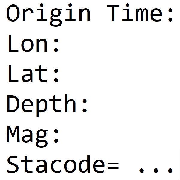
Earthquake Report No.101
- Origin Time: 2025/06/15 05:07:13
- Epicenter: 23.49°N, 121.31°E 64.1 km SSW of Hualien County Hall
- Focal depth: 14.6 km
- Magnitude (ML): 4.2
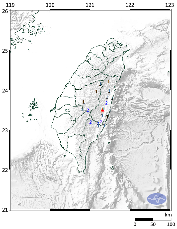
Intensity
Hongye 4
Guangfu 2
Fuli 2
Yuli 1
Shitiping 1
Xilin 1
Shuilian 1
Tongmen 1
Xibao 1
Yushan 2
Xinyi Township 1
Aowanda 1
Hehuanshan 1
Haiduan 2
Lidao 2
Chenggong 1
Changbin 1
Chishang 1
Alishan 1