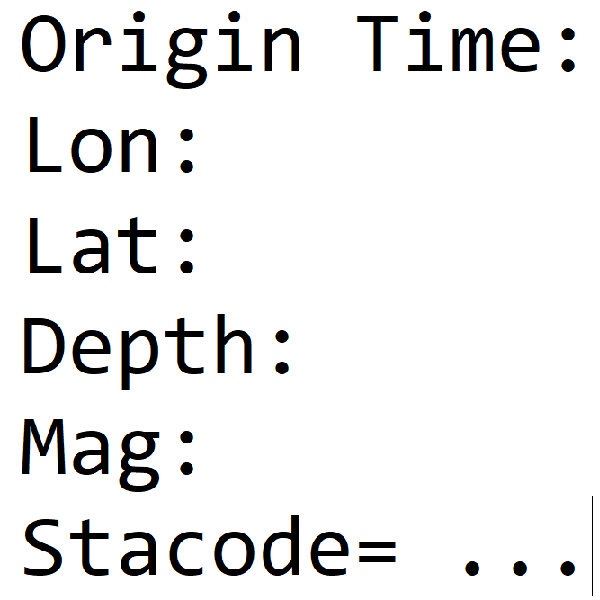
Earthquake Report No.113
- Origin Time: 2025/08/19 03:55:47
- Epicenter: 24.15°N, 121.84°E 28.0 km NE of Hualien County Hall
- Focal depth: 22.4 km
- Magnitude (ML): 4.5
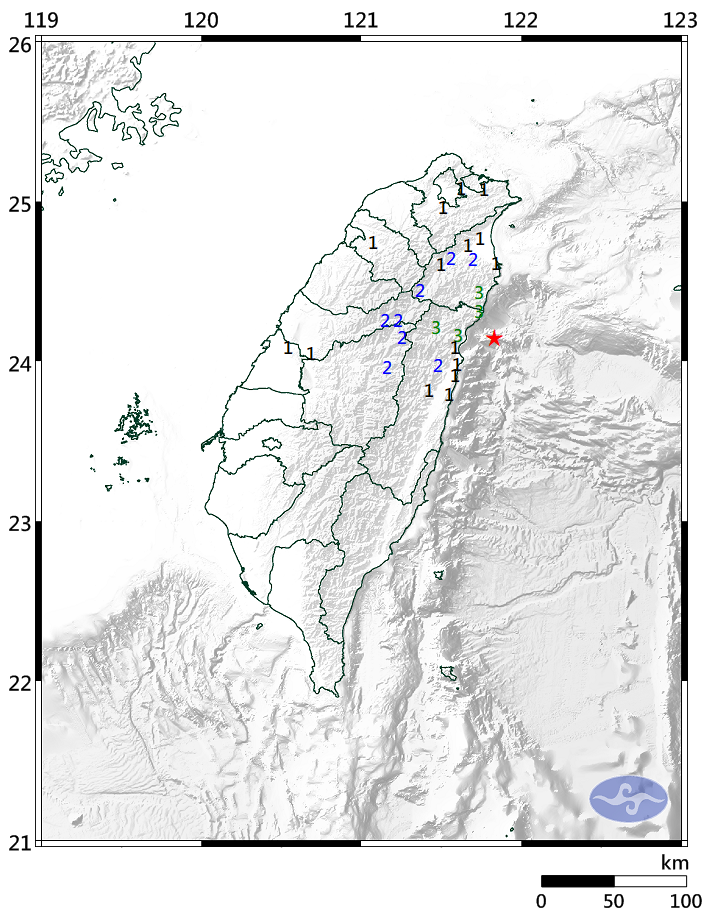
Intensity
Heping 3
Taroko 3
Xibao 3
Tongmen 2
Xiulin 1
Hualien City 1
Yanliao 1
Shuilian 1
Xilin 1
Nan-ao 3
Dongshan 2
Nanshan 2
Niudou 2
Su-ao 1
Datong 1
Neicheng 1
Yilan City 1
Hehuanshan 2
Aowanda 2
Lishan 2
Deji 2
Wufeng 1
Zhutung 1
Xizhi 1
Xindian 1
Wufenshan 1
Changhua City 1