Earthquake Report No.020
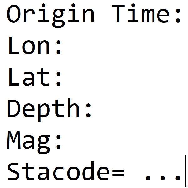
- Origin Time: 2026/03/06 23:14:25
- Epicenter: 24.16°N, 120.64°E 0.7 km SW of Taichung City Hall
- Focal depth: 27 km
- Magnitude (ML): 4.5
Intensity
Changhua City 4
Yuanlin 3
Lukang 3
Erlin 3
Dacheng 2
Taichung City 3
Wufeng 3
Wuqi 2
Dajia 2
Wushikeng 1
Deji 1
Lishan 1
Liyutan 2
Sanyi 2
Houlong 2
Zhunan 2
Taian 1
Miaoli City 1
Zhushan 2
Xinyi Township 2
Nantou City 1
Guoxing 1
Puli 1
Yuchi 1
Sun Moon Lake 1
Aowanda 1
Hehuanshan 1
Yushan 1
Tuku 2
Sihu 2
Shuilin 2
Mailiao 2
Xiluo 1
Gukeng 1
Caoling 1
Douliu City 1
Chiayi City 2
Taibao City 2
Yizhu 2
Minxiong 1
Alishan 1
Fanlu 1
Baihe 2
Jiali 1
Shanhua 1
Xinhua 1
Yongkang 1
Wufeng 1
Zhutung 1
Nanshan 1
Xibao 1
Guangfu 1
Hongye 1
Tongmen 1
Hualien City 1
Yanliao 1
Shuilian 1
Magong City 1