Earthquake Report No.036
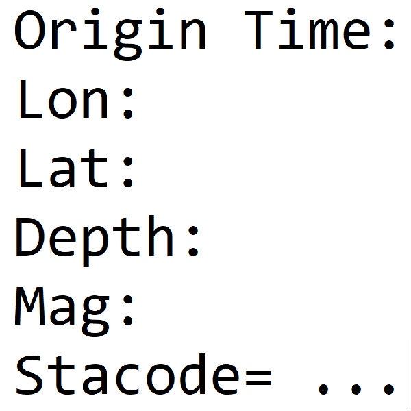
- Origin Time: 2026/04/25 15:16:34
- Epicenter: 24.85°N, 121.83°E 15.1 km NNE of Yilan County Hall
- Focal depth: 69 km
- Magnitude (ML): 4.8
Intensity
Niudou 3
Nan-ao 3
Yilan City 2
Neicheng 2
Dongshan 2
Nanshan 2
Toucheng 1
Su-ao 1
Datong 1
Sandiaojiao 2
Wulai 2
Xizhi 2
Xindian 2
New Taipei City 2
Shuangxi 1
Wufenshan 1
Wanli 1
Sanxia 1
Wugu 1
Tamsui 1
Xinyi District 2
Taipei City 2
Muzha 1
Sanguang 2
Taoyuan City 2
Xinwu 2
Daxi 1
Zhongli 1
Heping 2
Taroko 2
Xibao 1
Hualien City 1
Yanliao 1
Tongmen 1
Shuilian 1
Keelung City 1
Guanxi 1
Wufeng 1
Zhubei City 1
Zhutung 1
Hsinchu City 1
Nanzhuang 1
Zhunan 1
Houlong 1
Sanyi 1
Lishan 1
Deji 1
Hehuanshan 1
Changhua City 1